-
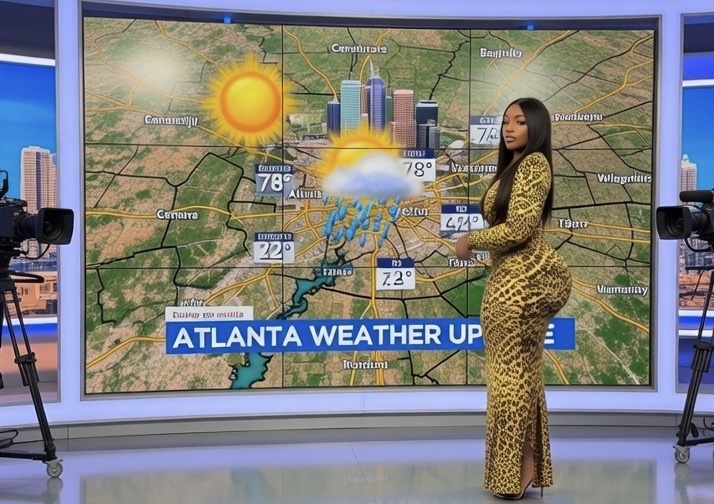
After a chilly start to the week with a Cold Weather Advisory in effect through this morning (Feb 23), conditions will moderate noticeably tomorrow.
What Is The Weather Going To Be Like Today?
- Conditions: Sunny and dry all day. Skies will remain mostly clear to partly cloudy overnight into Tuesday.
- High Temperature: Near 52–53°F (some spots around the city and northern suburbs may top out closer to the low-to-mid 50s).
- Low Temperature (Tuesday night): Around 38°F.
- Wind: Light northwest winds around 5 mph during the day, becoming light and variable overnight.
- Precipitation Chance: 0% — dry weather expected.
- Other Notes: Winds will be much lighter than today’s breezy and gusty conditions (which brought gusts up to 30 mph). Morning wind chills will still be brisk early Tuesday (probably in the upper 20s to low 30s at sunrise), but afternoon feels-like temperatures will be close to the actual air temperature. No hazardous weather is anticipated.
The extended outlook remains dry and warm for the next few days, with even higher temperatures possible Thursday and Friday, potentially approaching the low to mid-60s and setting some daily record highs. Rain and thunderstorm chances return late in the week into the weekend, but for now, it’s a great time to get outside and enjoy the mild February weather.
Stay tuned to weather.gov/ffc for the latest updates, as always from your National Weather Service. This forecast is based on data current as of Monday evening, February 16, 2026.
Special Notes
Stay tuned to AtlantaFi.com for updates, and check the National Weather Service at weather.gov/ffc. Stay tuned for updates as conditions evolve.
-
As tornado season fades and the Atlantic hurricane season ends, Georgia homeowners face a stark reality for 2026: the Peach State is increasingly storm-prone.
In 2024, there were 1,765 storm events recorded in Georgia, landing it at No. 10 in a nationwide ranking of states hit hardest by extreme weather.
With an average of 55.6 tornadoes annually and $6,891 in property damage per incident, Georgia’s vulnerability underscores the urgent need for roof readiness, according to a new study by Instant Roofer, a roofing analysis company.
“Georgia’s mix of tornadoes, thunderstorms, and tropical systems can turn a single storm into a six-figure repair bill,” says Jeff Berzolla, CEO of Instant Roofer, an AI-powered platform delivering instant roofing estimates across the U.S. “Homeowners in Atlanta, Savannah, or Macon need to inspect their roofs today—not after the first hailstone hits.”
Georgia’s Storm Snapshot
Instant Roofer analyzed National Centers for Environmental Information data covering hail, high winds, thunderstorm wind, and tornadoes. Georgia logged:
- 1,765 total storm events in 2024
- 56 thunderstorm days
- 55 strong wind events
- Annual average of 55.6 tornadoes (2020–2024)
- Average property damage: $6,891 per event
- Composite risk score: 74.10 / 100
Only nine states—led by Texas (3,680 events, score 87.40)—faced more frequent or severe storms.
Georgia outpaced regional rivals Florida (1,120 events) and Alabama (1,366 events) in total volume, driven by a higher tornado count and consistent thunderstorm activity.
Why Georgia Roofs Are on the Front Line
- Tornado alley overlap: North Georgia sits in “Dixie Alley,” where spring supercells spawn long-track twisters.
- Hurricane season spillover: Coastal and south Georgia brace for tropical storm winds and flooding rains from June through November.
- Hail the silent killer: Golf-ball-sized hail routinely punctures asphalt shingles across metro Atlanta and the Piedmont.
“Even a Category 1 hurricane 200 miles offshore can strip loose shingles with 80-mph gusts,” Berzolla warns. “Combine that with Georgia’s aging housing stock—many roofs over 15 years old—and one storm can cascade into interior water damage, mold, and insurance battles.”
Georgia vs. the Nation: Top 10 Most Storm-Prone States
Rank State Total Storm Events 2024 Avg. Tornadoes (2020–2024) Avg. Damage per Event Score 1 Texas 3,680 103.2 $48,839 87.40 2 Illinois 2,391 98.2 $6,402 85.67 3 Kansas 3,017 45.8 $1,247 83.30 … … … … … … 10 Georgia 1,765 55.6 $6,891 74.10 (Full top-10 table available at InstantRoofer.com)
Safest States Offer Stark Contrast
Hawaii (8 events) and Alaska (83 events) anchor the bottom, with average damage under $250 per incident—proof that location matters. Georgia homeowners, by contrast, paid roughly $12.2 million in storm-related property damage in 2024 alone.
Action Plan for Georgia Homeowners
Berzolla offers a three-step checklist:
- Inspect now – Climb (safely) or hire a pro to check for cracked shingles, rusty flashing, or clogged gutters.
- Fortify – Upgrade to impact-rated shingles or metal roofing; secure loose ridge vents.
- Insure smart – Confirm wind/hail coverage; consider a separate flood policy—standard homeowners insurance excludes it.
“An ounce of prevention beats a pound of FEMA paperwork,” Berzolla says. “Instant Roofer’s free AI tool scans your address and delivers a custom estimate in seconds—no spam, no signup.”
Methodology
The study normalized five metrics—tornado frequency, thunderstorm days, strong wind events, total 2024 storms, and average damage per event—into a 0–100 score. Data sources: Mental Floss (tornado averages) and NCEI Storm Events Database (2024 incidents).
More From AtlantaFi.com:
-
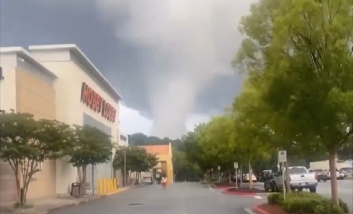
Onlookers in Cobb County, Georgia, were struck with fear on Tuesday, July 1, 2025, when they looked in the sky and saw what looked like gray clouds swirling above them.
Metro Atlanta had been getting heavy rain of late along with alerts about possible hail and yes, tornadoes.
Was That a Tornado in Cobb County?
According to meteorologists, what occurred that day in Cobb was not a tornado, but what is known as a “scud cloud.”
What Is a Scud Cloud?
A scud cloud, also known as pannus cloud or fractus cloud, is a low-hanging, ragged cloud formation often seen beneath other clouds, particularly during thunderstorms.
They are frequently mistaken for funnel clouds or tornadoes due to their appearance and movement, but scud clouds are harmless and lack the organized rotation of those more dangerous formations.
Cowboy State Daily meteorologist Don Day says in Wyoming, scud clouds are frequent.
“When you get into a thunderstorm situation, there’s a lot going on at the base of those clouds,” Day is quoted as saying. “You can get these little vortices that will spin off the base of a cloud and take a piece of cloud with it. Scud clouds are basically pieces that have broken off larger clouds.”
Appearance and Formation:
- Scud clouds are typically low-hanging, ragged, and detached from the main cloud base.
- They form when warm, moist air rises and condenses at lower altitudes than the main cloud base, often due to mixing with cooler air descending from the storm.
- This condensation can create the appearance of swirling or rotating, especially when they are pulled upward into the storm’s updraft.
- Scud clouds can be associated with rain or precipitation, but they are not inherently dangerous.
Distinguishing from Funnel Clouds and Tornadoes
The key difference is the lack of rotation. Scud clouds, while sometimes appearing to spin, lack the organized, cyclonic rotation of a funnel cloud or tornado.
Scud clouds are also generally more ragged and less defined than the smooth, cone-like shape of a funnel cloud.
Final Word
No, thst wasn’t a tornado. It was a scud cloud. They are often found near the base of the main cloud but are not connected to a visible wall cloud (a rotating cloud base from which tornadoes can develop).
-

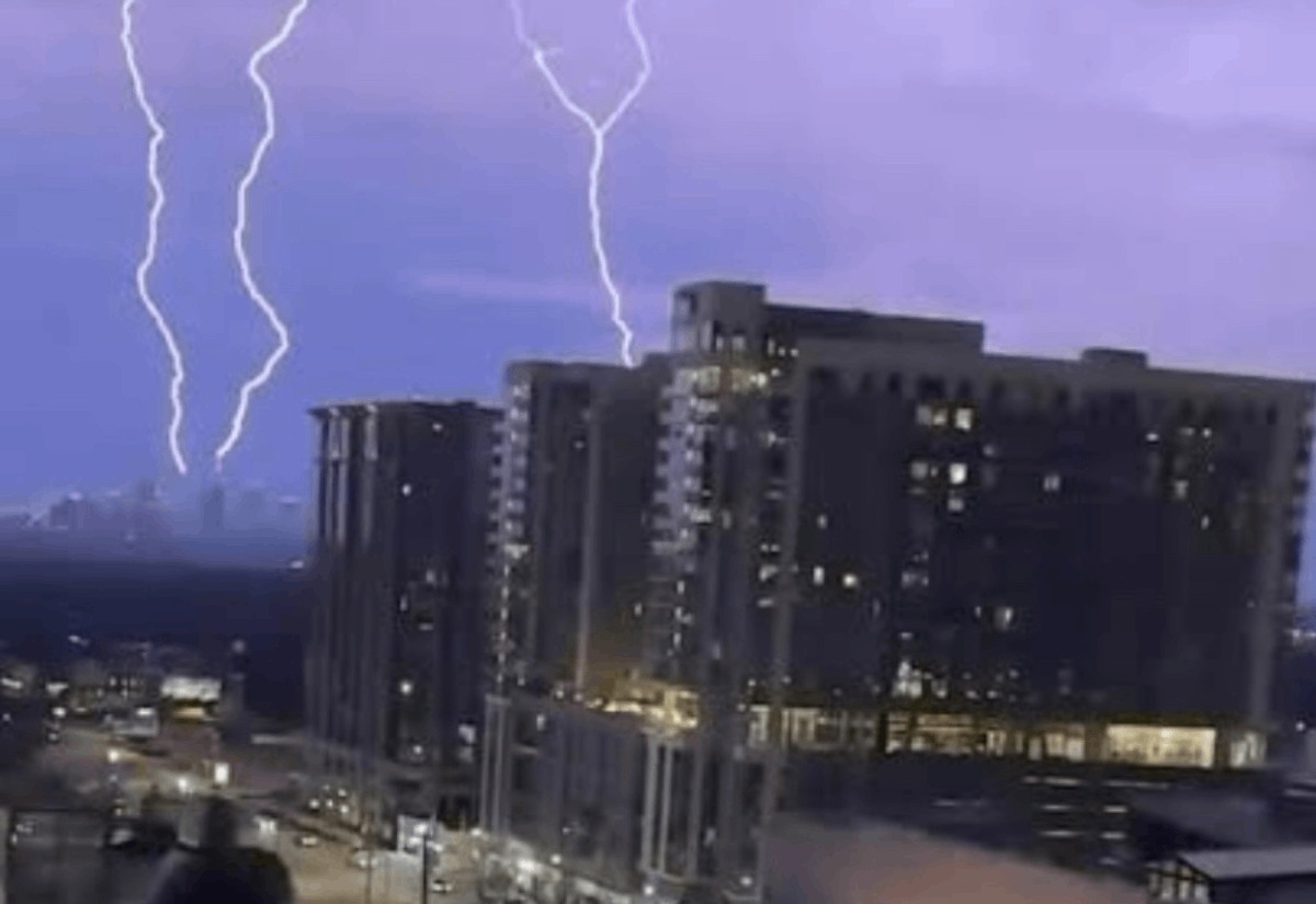
Showers and severe thunderstorms have hit metro Atlanta day in and day out since the summer began. There’s been warnings about possible tornadoes, hail and more.
During the last week in June, downpours caused flash flooding on I-75 downtown, bringing traffic to a near standstill.
The Atlanta-area is still recovering from severe storms on June 7 and 8, which caused one fatality in Banks County when a tree fell on a car and left over 200,000 without power. Cleanup continues in areas like Dunwoody and Roswell, where trees and power lines were downed.
Why Is It Raining So Much in Atlanta?
Atlanta’s heavy rainfall in mid-June 2025 stems from a combination of seasonal weather patterns and specific meteorological conditions.
“We’ve gotten 7 inches of rain this month,” Atlanta News First meteoroligist Ella Dorsey posted on social media.
Here’s is what’s been going on with Atlanta’s stormy weather:
- Summer Weather Patterns: Atlanta’s subtropical climate typically brings increased rainfall during summer due to high humidity and heat, which fuel thunderstorms. June is often one of the wetter months, with average rainfall around 4–5 inches.
- Current Conditions: Recent weather data indicates a stalled frontal boundary over the Southeast, combined with abundant moisture from the Gulf of Mexico. This setup creates frequent showers and thunderstorms, particularly in the afternoon and evening when daytime heating peaks. The National Weather Service (NWS) Atlanta noted scattered thunderstorms in the forecast for June 16, with potential for heavy rain due to slow-moving storms.
- Recent Storms: Metro Atlanta is still recovering from severe storms on June 7–8, which dumped significant rain and caused widespread damage. The lingering effects of these systems, along with saturated soils, amplify the perception of excessive rain.
- Climate Context: While Atlanta’s rainfall is within normal seasonal bounds, climate change may intensify extreme weather events, leading to heavier downpours when storms occur. However, no specific data ties the current rainfall directly to long-term climate trends.
Rainy Days in Atlanta: How To Prepare
- Carry Rain Gear: Keep an umbrella, raincoat, or poncho handy. Waterproof shoes or boots are ideal for navigating wet streets or sidewalks, especially in areas prone to puddling like Downtown or Midtown.
- Stay Weather-Aware: Monitor the National Weather Service Atlanta or apps like AccuWeather for real-time alerts on thunderstorms, which may bring lightning, gusty winds, or heavy rain. Have a NOAA weather radio or phone alerts enabled for severe weather warnings.
- Plan Outdoor Activities: With afternoon and evening storms likely, schedule outdoor plans (e.g., Father’s Day events or Juneteenth festivals) for earlier in the day or check for indoor alternatives. Venues like the College Football Hall of Fame or High Museum of Art offer sheltered activities.
Home and Property
- Check Drainage: Clear gutters, storm drains, and downspouts to prevent flooding, especially after the June 7–8 storms left some areas waterlogged. Low-lying neighborhoods like Peachtree Hills or parts of DeKalb County are flood-prone.
- Secure Outdoor Items: High winds often accompany Atlanta thunderstorms. Secure patio furniture, trash cans, or decorations to avoid damage or debris hazards.
- Prepare for Power Outages: Recent storms caused widespread outages (over 200,000 affected earlier this month). Keep flashlights, batteries, and a charged power bank ready. If you have a generator, ensure it’s functional and safely stored.
- Driving Safety: Atlanta’s roads, like I-285 or I-75/85, can become slick or flooded during heavy rain. Maintain extra stopping distance, use headlights, and avoid flooded areas (e.g., underpasses in Downtown). Check 511 Georgia or Waze for road closures or delays.
- Airport Travel: If heading to Hartsfield-Jackson Atlanta International Airport, arrive three hours early due to high traffic (195,000+ travelers expected this week). Monitor flight statuses, as thunderstorms can cause delays. Park in covered lots if possible to avoid wet treks.
Final Word
Rain is no fun, but it’s life. If you’re dealing with flooding or travel issues, monitor road conditions via 511 Georgia or Atlanta’s DOT updates.
Also, MARTA buses and trains may face delays during heavy rain. Check MARTA’s app or website for service updates, especially for routes in flood-prone areas like West End or East Atlanta.
-

Prolonged high concentrations of dust are expected over metro Atlanta and much of Georgia over the next three to four days.
The large Saharan dust plume, described as one of the biggest of the 2025 season, has already reached Florida as of June 4 and 5, after traveling over 5,000 miles from North Africa.
It is expected to spread to other Southeastern states, including Georgia, the Carolinas, Louisiana, Mississippi, Alabama, and Texas, through the weekend. The dust is causing hazy skies, reduced visibility, and vibrant sunrises/sunsets due to light scattering by dust particles.
People who experience adverse effects due to dust exposure should take precautions.
Saharan dust, carried by the Saharan Air Layer (SAL), is a well-documented phenomenon where dust from the Sahara Desert travels across the Atlantic Ocean, often reaching the southeastern U.S., Gulf Coast, and Caribbean. The references confirm that a significant Saharan dust plume is already affecting the U.S. in early June.
Potential Health Impacts
Respiratory Effects: The dust contains fine particulate matter (PM2.5 and PM10), which can be inhaled deeply into the lungs, irritating airways and triggering:
- Coughing, wheezing, or shortness of breath
- Throat and nasal irritation
- Worsening of allergies or sinus issues
- Vulnerable Populations:
- Children: Developing lungs and faster breathing rates increase susceptibility.
- Older Adults: Reduced lung function or existing health issues heighten risk.
- People with Respiratory Conditions: Those with asthma, COPD, bronchitis, or emphysema may face exacerbated symptoms, potentially leading to asthma attacks or the need for medical care.
- Heart Disease Patients: Dust can inflame blood vessels, raising risks for cardiovascular issues in those already at risk.
- Healthy Individuals: May experience mild symptoms like itchy eyes, scratchy throat, or minor coughing, especially during heavy dust concentrations.
Here are more articles from AtlantaFi.com:
-

People around Atlanta are preparing for an arctic blast Friday evening. That means it’s going to be frigid temps for most of the weekend.
Forecasters said a wintry mix would be possible for metro Atlanta at some point. The center will open Friday February 2, 2018 at 6:00 p.m. and remain open until 12:00 p.m. Saturday, February 3, 2018.
The City of Atlanta has opened a warming center for those in need of a warm place to stay. It is located at the Old Adamsville Recreation Center, 3404 Delmar Lane NW, Atlanta, GA 30331.Central Park Recreation Center Grant Park Recreation Center Old Adamsville Recreation Center.
For more info, please call 404-330-6023.